


Exploring Sot de Chera: nature, history and rural beauty
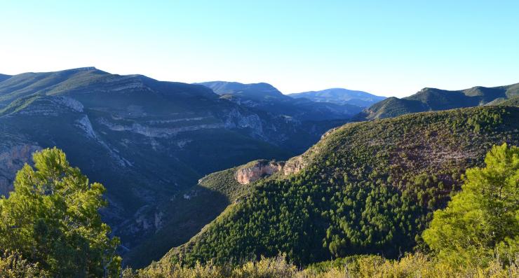
Sot de Chera is one half of the Chera-Sot de Chera Natural Park, which, as you might imagine, is located between those two towns.
Both villages have a rich heritage that is well worth a stroll, but the greatest treasure they share is the Natural Park, of course: more than 6,000 hectares of gorges, caves and green valleys that make it a territory with exceptional geodiversity, biodiversity and hydrological richness. It is 67 kilometers north of València and 40 from Requena.
Let's get to know the essentials of this valuable Valencian natural environment so you can make the most of your excursion.
What to see in Sot de Chera
Apart from hiking, there are a few more plans in Sot de Chera that you should put on your agenda.
The Hermitage of San Roque in Sot de Chera: a mandatory stop
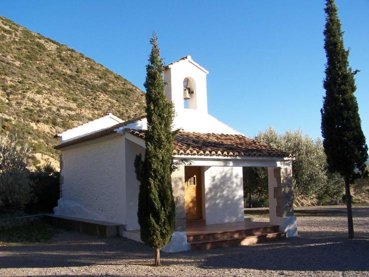
The Hermitage of San Roque is almost like another citizen of Sot de Chera because, although it is 500 meters from the village, its candles are always lit and it is easy for any inhabitant of Sot to open its doors for you.
This hermitage, dedicated to the town's patron saint, is Renaissance in style and has a recreational area on its esplanade. Additionally, there are fantastic views of the Sot de Chera valley from there.
Charco Gruñidor: a very fresh natural pool
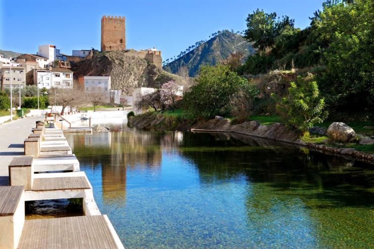
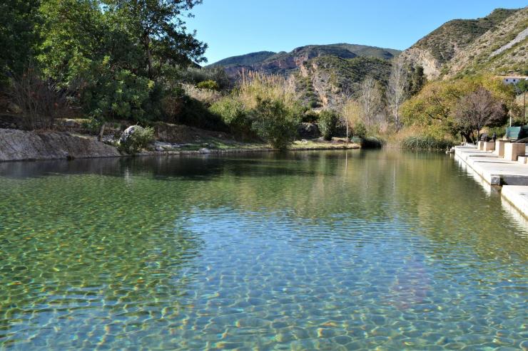
Don't let the name "El Charco del Gruñidor" (The Grunter's Puddle) scare you; it's a very friendly place. What's more, you can even swim in it, which is much appreciated in summer. In winter it's another story, as the temperature doesn't invite a soak, but it's a very pleasant walk.
It is a natural pool gifted by the Sot River that will transport you to another era. That said, please be very careful with the environment so that its waters remain clean and crystal clear.
Las Toscas in Sot de Chera: a crystal-clear waterfall
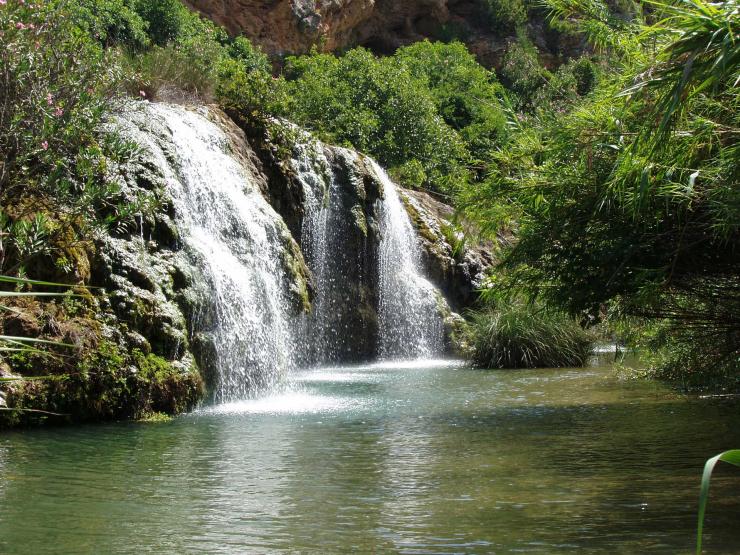
And speaking of crystal-clear waters and transporting yourself to other times, Las Toscas is another place in the Chera-Sot de Chera Natural Park that has that effect. It is not for nothing that it is considered a priority habitat by the EU due to the importance of its geology and vegetation.
It is a spring of the Sot River, in the middle of the mountains, with a waterfall and a cave that connects through two different entrances. If you swim, go into the cave and be amazed by the color of the water. It is always advisable to respect the environment, but here you must be especially conscious and pass through Las Toscas without damaging the site.
The Sot de Chera River
The Sot de Chera river is called… exactly: it's the Sot River. Along its 12 kilometers, it also has the Las Fuentes spot, where it originates, and La Canal, where the river forms natural pools surrounded by abundant vegetation and remains of a Roman aqueduct. You couldn't ask for more, don't you think? For good reason, alongside the Sierra Calderona Natural Park, it is one of the most beautiful excursions north of València.
What is missing for a day in Sot de Chera to be perfect? Food! The mountains make you very hungry.
Well, let's get to that. We are going to recommend a couple of fabulous places to eat in Sot de Chera.
Eating in Sot de Chera
Eating in Sot de Chera: El Cerrao
El Cerrao is a perfect hostel to stay overnight if you want to spend a few days in the Natural Park, especially if you are traveling as a family. But, additionally, they have a restaurant that offers traditional dishes with a signature twist made with local ingredients.
Eating in Sot de Chera: La Placeta
As its name suggests, it is in a square in the middle of the village and eating on its terrace is a pleasure in itself. But, additionally, it has a very varied menu and, more importantly, it is original and of high quality.
Chera-Sot de Chera Natural Park: hiking routes for everyone
As we said at the beginning, nature in the Chera-Sot de Chera Natural Park is a marvel. That's why you have to do a hiking route no matter what.
So you know where to start, we have made a selection of hiking routes in the Chera-Sot de Chera Natural Park of various levels. Take note:
- Chulilla, hanging bridges route: high difficulty, 7 h, 3 km.
- El Barranco de la Hoz: medium difficulty, 4:30 h, 15 km.
- Morroncillo Viewpoint: medium difficulty, 3:30 h, 10 km.
- The Water Route, Reatillo River: low difficulty, 1 h, 4 km.
- La Cuesta Larga: medium difficulty, 4 h, 12.5 km.
- Charco Azul Viewpoint - Charco Azul: medium difficulty, 2 h, 8 km.
- Research and find the one that best suits you and your company.
```